Thursday, March 29, 2018

March 2018


In which weather, in Scotland and the Bahamas, delays our progress but we make it as far South as Great Inagua before turning North.

Having been delayed by ‘The Beast from the East’ I finally returned to Elsie and Ruby at Emerald Bay Marina, Exuma, on Sunday 4th March. A weather window for exiting and proceeding to Rum Cay had passed 2 days earlier and Northerly winds were forecast for the next 3 days. The swell was augmented by a very deep depression in mid Atlantic, which had surfers raving about the ‘best’ waves for a decade from the American seaboard through to the Virgin Islands. We wandered down to the harbour entrance a couple of times each day to watch the water and, occasionally, a boat entering or leaving. There seemed to be a pattern – 3 or 4 huge waves breaking right across the entrance, followed by several minutes of unbroken, but still huge, swell. With the northerly wind, an engine failure at the critical point would rapidly leave you beam on to this and swept onto the rocks within a couple of minutes.
Beacon

Church door

Elsie had hired a car to collect me from the airport. $60 for the day compared to taxis at $30 -40 each way. It wasn’t much of a car but it did the job and we took a trip down to the bottom of Little Exuma that afternoon. We found a pillar which had acted as a beacon to guide boats in to collect salt when it was being harvested from ponds a century earlier and a beautiful little church with modern stained glass windows. And door. We also used the car for a fairly major provisioning trip on Monday, before fitting the new wind generator with help from a neighbour (and his tools). Tuesday and Wednesday were just spent weather watching with daily walks, either through the adjacent Sandals resort or a stalled private development.

Finally, on Thursday 8th, the wind shifted to the southwest. The swell was still larger than we would have liked but I figured that, if the worst happened with an engine failure, we would at least be able to sail clear. One false start, with a train of breaking waves coming sooner than expected, then a dash for freedom and 5 minutes later we were outside in fine sailing conditions, broad reaching the 47 miles back to Thomson bay on Long Island. Here we stayed for a further 5 days, moving twice to shelter from shifting winds and having the occasional trip ashore for a walk when they were not too strong.

At last, on the 13th, we saw a window to make progress to the East and Aklins Island. It was a round-about route to get shelter for overnight stops. First, we headed West, back through the Comer passage and down to Water Cay. The first bit was a fine beam reach and second leg was a slow run. The wind, which should have shifted to East of North, failed to do so but we were comfortable enough and, as it looked worse than it was, only one other yacht joined us so we had plenty of space. Our neighbour was a young American couple who were having a fairly torrid time beating to wind on a 40 year old, 30 ft yacht with no auto pilot or weather updates. They had been stuck in Florida, crossed to Cuba with only a 14 day permit and were looking forward to a bit of peace. We were able to give them the good news that, if they were prepared to motor into wind the next morning, they should then have a good sail into Thomson Bay. For ourselves, we decided that we would get better winds by waiting a day, so spent the 14th at anchor with a nice walk along the beach. On the 15th, we back-tracked a couple of miles North then broke free of the bank and into deep water for a 50 mile reach across to Gordons Bay at the south end of Long Island.  Most of the way, the wind was on the beam, so it was Elsie’s treat. She had to work a little harder for the final 10 miles but we found a comfortable spot and settled in for the night. The next leg, across to Aklins Bight, was 20 degrees further to starboard but unfortunately the wind veered 45 degrees so we had a 35 mile close reach the following morning. Once inside the bight, we had to motor for a while but got another nice close reach for the final 12 miles down to Camel point, which provided good shelter. Our days run of 62 miles being our furthest for a few months, we felt our sun-downer rum punches were especially deserved.

Having finally got to Aklins, we weren’t sure what to do next. Once again, using the available winds would take us to places with poor shelter or trick entrances so we decided to chill for a couple of days and just do a few little routine maintenance jobs. On the 19th, the wind shifted to the south and we re-positioned round the corner to anchor as close as we could to Spring Point settlement, where there was reputed to be a store. The nearest we could get still left us with a ¾ mile dinghy ride but our first impressions were good when a car coming in the opposite direction stopped to ask if they could help us at all. The next vehicle was an out-of service school bus going the same way as us. He also stopped to chat, told us that the local store was poor and he could give us a ride to a better one a few miles away as he was going that way anyway. We accepted. This store was acceptable (though no chicken!) and also had a restaurant attached and, as we had failed to make provision for lunch, we ate (good local fish, chicken or pork, with beans and rice). Our driver also ate and gladly accepted our offer to pay for him. While eating a loud discussion broke out about local religious affairs, in which our man appeared to be chief stirrer and we discovered far more than we wished to know. Having eaten, as he was now returning south, we accepted a lift back. In the absence of service buses, hitching is an accepted means of travel here. We have enquired and been told that payment is not expected and an offer may even cause offence, so I was a little surprised at the driver angling for and accepting a tip in addition to his lunch. It’s not wrong but it seems out of place here. Coupled with the theocracy (apparently 19 churches of various denominations for a population of about 600) it left a slightly sour taste. Probably not our favourite destination.
Lunch stop

We had been humming and hawing about whether, given the poor aid from the weather this year, it was time to head north but, looking at the long range forecast, we reckoned we could make one further trip south. To position ourselves for this, we heaved up on the morning of the 21st and sailed the 20 miles back across the Bight of Aklins to anchor near the entrance. Again, we ended up about ¾ mile from the shore and dinghied in to have a look at the small settlement of Albert Town on Fortune Island. There is a little pier, with a channel in marked by posts. Even following this, the water was very shallow and, on the return, we sat as far forward as possible to give a couple of inches extra clearance to the propeller, turning at minimum revs. To reach the settlement, we had to walk about a mile along a rough track to discover half a dozen houses, a telecoms office and a small beach. At least we got some exercise.
Returning from Albert Town


We wanted a daylight arrival at Great Inagua, a voyage of about 110 miles, so we elected for a late afternoon departure. A quartering wind of 15 knots was forecast and we should be able to average at least 6 knots. We could always slow down or heave-to if necessary. Accordingly, after a bit of routine maintenance of sewage piping (always a pleasure!), we heaved up at 15:00 on the 22nd and headed out, only to discover that the wind, for once, was lighter than forecast and that we had a north-setting current of up to 2 knots. It looked like we had miscalculated badly and might not make our destination in daylight. Apart from that, it was a pleasant sail, our first over-nighter since arriving in the Bahamas 3 months ago. The wind picked up a little, giving us a voyage average of 6 knots through the water (so, at least, I got that bit right) and the current reduced to about a knot. We arrived off Mathews Town at 13:00. Now, we had a further dilemma. The pilot book states that the small harbour is subject to surge and that there are obstructions and a shallow entrance, dangerous in a swell. We understood that the entrance had been dredged (and it was near high water) but there was a significant northerly swell running. There was an anchorage 10 miles further on, on the south coast. Having got trapped at Emerald Bay, we were wary of this harbour entrance and elected to continue. The chart, and book, suggested a comfortable berth, with clear sand and protection from swell, a mile or so offshore, inside a reef. The chart also hinted at a closer in spot so we headed for that, hoping that we would be able, the following day, to dinghy ashore, hitch into town and check the harbour for ourselves. We dropped sails at 15:00 and tried, unsuccessfully at the closer in one, but found poor holding, so went to the recognised anchorage. Either coral grows very quickly here or other peoples’ idea of clear sand varies from mine. We did eventually find a clear area, dropped the hook, and settled for the night, though it was not as smooth as we would have wished. The following day, with the wind still in the same direction but stronger, the swell changed direction making it even more uncomfortable. As an experiment, I attached a second line from our anchor cable to a midships cleat. This veered our bow round, making us pitch rather than roll. We spent a second uncomfortable night. In the morning, the wind had veered and decreased so we decided to pick up and head into town. By now, we were pitching heavily and had extra cable out from the previous days manoeuvres. The chain caught a couple of times on a coral head resulting in distress to both. Elsie had had a bad night so we just motored back to Mathews Town. We gingerly approached the harbour, to find it clear, with brand new docks, no surge and 15 ft of depth. It being Sunday, there was no-one around. There was a concrete dock for the defence force; one being used by Haitian trading sloops, with the only space next to a RoRo ramp and a wooden dock which we suspected might be private. As is was fairly calm outside, we exited and anchored outside, returning by dinghy for a walk ashore. We then bumped into people who told us that we could have used the wooden dock.
Trading sloops

 On Monday, we came in again and tied up to this and met the dock master, who told us a bit about the re-development and charged us $10 per night- cheapest dock we have seen since the Canaries 2 years before.. Walks ashore took us to the supermarket, not as comprehensive stock as hoped and, later, to the lighthouse. This, remarkably, was unlocked with a visitors’ book so we gave ourselves a self guided tour. The harbour was calm and we would have had a wonderful night’s sleep had we realised in time that there were small biting insects which followed us into our cabin. On subsequent evenings, we saluted the setting of the sun and immediately retreated below.
Lighthouse

view from the top

On Tuesday we took a tour with a local, unofficial, taxi to see the salt ponds, new and old. Great Inagua is effectively a vast sea salt farm with pumps constantly pumping water into the huge lake in the interior where it becomes concentrated brine by evaporation. This is let into dozens of shallow ponds, each about 50 – 60 acres and allowed to dry out over a period of about 3 months. The resulting salt, 6 – 9 inches deep, is then scraped into ridges by a grader then lifted into trucks for a rinse and final dry before being exported. The whole island economy depends on Morton salt. If they misuse this dependence, no-one here is saying.
Salt mountains

Harvesting

The wind had built during the week but was due to decrease and veer on Thursday so, on Wednesday afternoon, having spent the morning lugging cans of water to top up out tanks, we went to the store, only to find that it was half day closing. As it looked like Friday would give us a more comfortable sail, we decided to delay a day, and concentrate on planning our summer journey back to the U.K., including booking non-refundable air tickets. Early communications on Thursday brought a response that our planned shipyard could not accommodate us! There were some choice words said and frantic appraisals of alternatives before it appeared that someone thought we were a new booking and that we were expected after all. The wind had veered and swell was now entering the harbour, causing us to surge along the slip, needing improvements to our moorings. A check on the weather revealed that there might now be less wind than ideal with a Friday departure but, with provisioning still to be done and distress still lurking from the mornings confusions, we decided to stay the extra day. There were alternative stopping places, at Rum Cay and Conception Island if it looked as though we would not make Cat Island in daylight.

Provisions were a little sparse as, instead of the usual practice of weekly mail boats, they appear at random here. There had been 3 at once 10 days before and a local sports event had brought visitors, emptying the shelves. Never mind, it was time to start emptying the larder of emergency rations and some adventures in cooking. Who knew that a few handfuls of macaroni, a jar of Alfredo sauce, half a tin of Spam and a sprinkling of indifferent cheese could make a tasty, nutritious supper? Elsie had a productive afternoon baking and the cookie jars were full for our onward voyage.

Up at first light on the 30th and let go at 0740.  The wind was a nice F4 easterly, veering during the afternoon to ESE.  This meant it was a little further behind the beam than ideal, but we still moved along nicely at 7 knots with one reef in the main.  We had a second reef in for a while during the afternoon watch and again at 2300, for Elsie's night watch.  This was as well because, unforecast, there were a succession of squalls with heavy rain and gusts to 30 knots. I got dug out of my bunk at 0300 to assist with the 3rd reef. The voyage back to abeam Albert Town was made in 16 hours and, at this point, we decided to make for our favourite Conception Island. We made this by midday on the 31st, dropping anchor in the north east of the bay. Unfortunately, we didn’t have it completely to ourselves but it was nice to be back.
Monthly distances:
Logged              615
Over ground      566

Monday, March 19, 2018

Children of the Magenta


I have been a navigator all my adult life. I was a deck officer in the Merchant Navy in the days when coastal navigation was done by taking bearings of lights, buildings and even trees; deep sea, we used sextants and wind-up chronometers. If it was cloudy, we were sometimes using ‘dead reckoning’ for days on end. There were some electronic Nav Aids, but they were inaccurate and unreliable. The first satellite system used single transits and you were lucky to get a fix every 20 minutes or so. I then became a commercial helicopter pilot. Officially, we navigated by ground radio beacons, NDBs and VORs. In fact, the aircraft were fitted with smart boxes which interpreted Decca signals to fly us from waypoint to waypoint, but signals were frequently lost and large jumps encountered switching from one chain to the next and we always monitored the fixed aids. The more experienced the pilot, the less inherent trust he had in the automatics. There is a, possibly apocryphal, story of a new airliner reaching a waypoint and, instead of turning left as expected, it turned right. Within two minutes, the tech savvy Co-Pilot had worked out why this had happened; within 2 seconds, the Captain had disconnected the auto-pilot and corrected the course.

With the introduction of GPS and ever more sophisticated navigational aids, an airliner can fly itself from take off until landing; even a helicopter can manage, while above about 80 knots, with just the occasional push of a button. The system is so accurate and reliable that there is a temptation to let the system do the work and relax the monitoring: as long as the aircraft is following the magenta line on the flight management system, all is right with the world. This works most of the time but just one little error in route entering can spell disaster. The older, more experienced, generation fight against this tendency and use the pejorative phrase ‘Children of the Magenta’ to describe pilots who blindly accept what the system is telling them without cross checking other sources.

My third age of navigation has been sailing. When I first re-started, in 2010, I used paper charts. Fixes, using a hand compass, were taken at appropriate intervals and plotted. Transits and clearing lines were employed. The log recorded waypoints passed. Our chartered yacht might have a chart plotter, but this was strictly back-up to ‘proper’ navigation. Even when we bought Ruby, we ensured that we had the best paper charts for the area and plotted our positions. As time passed, and we gained more confidence in our chart plotter, we progressed to just having sufficient paper to ensure that we could make a safe harbour if it failed. Then to having back-up electronic charts on the phone. Our positions are logged by lat / long, directly from the GPS.

The last few months have been spent in the Bahamas. While the water on the Atlantic side and between islands is many thousands of metres deep, the banks are very shallow with, in places, many coral heads. At first, we took them at low speed with a look-out on the bow but have now got used to sailing for miles with only a few feet below us. The only charts that our, 12 year old, chart plotter will load are supplied by Navionics. These have a reputation for poor coverage in this area so we have used them with caution. On passing through in the Spring, I purchased Wavey Line charts for my phone. These are good, but are not, unlike Navionics charts, stored on the phone, so require internet access, so may fail in inaccessible areas. Following our grounding in January, I also purchased Explorer charts for the phone. These are regarded as ‘Gold Standard’ but this ap has also let me down by freezing at times. What these charts do have is a plethora of waypoints linked by known tracks. I have no reason to believe that these tracks, apart from where they weave between specific charted dangers, are any deeper than anywhere within a few hundred metres. What they do bring is the knowledge that dozens, or hundreds, of other yachtsmen have followed them and, if there any rocks to be found on them, someone will have done so.  While paper charts are available, for vast areas there is nothing to take bearings from so one could only take satellite positions and plot them, something tha a chart plotter does automatically.

Accordingly, we now transfer the waypoints to our main plotter (treble checking each one) and sail or motor along the lines. It works, but I am not proud of this lowering of navigational practice. I have become a Child of the Magenta.

Sunday, February 18, 2018

February 2018

In which we have a week in the Jumentos and return to Georgetown.

Having spent nearly 2 weeks at Thomson Bay, Long Island, we finally got away on the 1st February. There was a stretch of our route which I wanted to pass with some height of tide beneath us so it was an early start, lifting anchor at 0640. We had transferred waypoints from our new explorer chart ap onto the chart-plotter so that we could cross-check from two sources. The wind was right behind us, F4, so we goose winged the main and full genoa. After about 12 miles of generous 5 – 6 metres beneath us, we came to the shallower section, where we had to follow a known cut for about 10 miles. At half tide, we never saw less than 2.9 metres, so we had probably been over cautious. We could now turn south, broad reaching and, as the wind increased to F5, put a bit of the sails away. With about 2 miles to go to our destination, our new ap failed. Fortunately, I had previously checked it for hazards and, although our Navionics data gave false depth information, we were able to feel our way in and anchored at Water Cay at 1420. On arrival, the only other boat in the anchorage was a local fisherman. They had a skiff which was sent out with three men on to free dive for conch in 10 – 12 ft of water. Their target was 500 conch per day until they had 4000 to take back. Each skiff load of 100 was brought back, a hole made in the shell then strung together and kept alive in the water until they were ready to leave. The foul weather that we had sat out at long island had also delayed them and their excursion was going to take them 10 days instead of their usual 8. We were later joined by 3 other yachts but they were put off by the fisherman running his generator all night and left early the next morning. We considered doing likewise but decided that we could stand the noise and stayed an extra day, having a good walk along several linked beaches.
Ruby with fishing boat at Water Cay

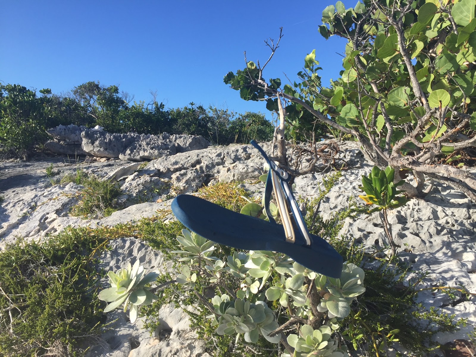
A later start on the 3rd took us 15 miles downwind to Two Tree Beach (which only has one tree) on Flamingo Cay. Here, we caught up with the boats which had left the day before and met up with them later on the beach for sun-downers, in the lee of a small bonfire which nicely kept the insects away. The afternoon was spent with a walk across a peninsular to another bay, the trail being marked at intervals with flip-flops dangling from bushes. Sadly, these markers are not hard to come by as windward beaches throughout the Caribbean are littered with them.
Trail marker

Off again on the 4th, a further 30 miles south to Buenavista Cay. Having had the wind just too far aft the previous 2 passages, today it was just too far forward. Most of the way we managed to sail close hauled into an ESE F4-5 but we were threading out way between reefs and had to motor sail for a couple of miles in the middle. Once again, we arrived in time for lunch and a lazy afternoon. There is a long double bay and 4 other yachts were anchored in the southern part but, having had to share for the previous 3 weeks, we went our own way and chose the smaller, northern one. Everyone else moved on the following morning leaving us in splendid isolation with a couple of miles of tropical white beach to ourselves. There had been one house on the island built by a native Bahamian, who enjoyed interacting with cruisers (and, allegedly, with other passing boats transiting with high value cargo). Hurricane Irma, the previous September, had wiped him out, leaving only foundations and a few chickens.  That evening, watching the sun set below a perfectly clear horizon, we saw the 'green flash' for the first time since we were in trhe Aeolians 18 months earlier.  Remarkably, the same happened the following evening.  Either the atmosphere was particularly clear or I am making the 'sundowner' rum punches stronger than usual.

We had been planning to spend 10 – 14 days exploring these islands but a check on the weather that evening revealed that the strong Easterlies were returning. With the exception of the coming Thursday, the wind would be 20 – 25 knots as far as the eye could see. Not wishing to be trapped, we determined that we only had 3 more days and to pick up early the following morning and head down to Ragged Island at the foot of the chain. We were delighted to be visited before leaving by a local fisherman who swapped 4 lobster tails for the latest weather forecast. The 25 mile sail down was a joy, with a F4-5 just ahead of the beam almost all the way, giving us 8+ knots. Into South Side anchorage, only to discover that, with a long fetch, the sea was too rough to comfortably reach shore. We had been in 2 minds about doing so anyway as the local town had been completely destroyed by Irma and we didn’t want to gawk. Instead, we had a leisurely lunch and a good catch-up on emails and other internetty stuff before picking up and heading 15 miles back North to Racoon Cay. We averaged nearly 8.5 knots this time with the wind behind the beam and arrived with 5 minutes to spare before the beach gathering organised by the crew of “Sam the Skull”, the brilliantly named Glasgow registered Cat. Also present was “Desiderata”, who we keep bumping into and, comparing notes, found that they had the same escape plan as us. Another early start (though not as early as Desiderata) on Wednesday and another brilliant 50 mile sail back to Water Cay.
Water Cay

Thursday was harder work. We had about 6 miles of motor sailing, hard on the wind, 15 sailing on a close reach then 11 miles back through the Comer Passage. This time we were near low water and had 2.0 – 2.2 metres showing on the depth gauge. Desidera must have nerves of steel as they draw a foot more than we do and kept pace with us. It was then 11 miles, directly into wind, back to Thompson bay. A couple of year’s ago, we would have sailed this (or even a couple of weeks earlier, when we were sailing deprived) but we just motored to ensure we had plenty of time for a provisioning trip, as the wind was forecast to get up again before morning. It did rise a little, but not enough to keep us on board and we had a long walk (8 miles) round the bay to Indian Hole point and back, pausing at Tiny’s for Oh-So-Good conch fritters on the way back. The wind did get up that evening and kept us confined for the next 4 days.
Post office at Thompson bay

Wednesday was a busy day: early dinghy trip to the fuel station, to drop off our propane tank (almost perfectly timed – it ran out just as I was finishing cooking on Tuesday evening, so I had to connect up the old camping gas for morning coffee); book swap and provisioning on the way back; over to Tiny’s for laundry (miss-timing, so we were 3rd in the queue) and a final trip back to collect the propane tank. Thursday, it was time to move on and we had a nice downwind run, first with just genoa and then with cruising chute, to Elizabeth Island, entering via Middle Rocks passage. Wea found a pleasant anchorage, on our own, which is remarkable for so close to Georgetown. On Friday, we motored the couple of miles to anchor off Regatta Point and make 4 trips ashore to top up with, free, R.O. water. We also did a little shopping (finding mango juice – hurray) and Elsie got her visitor’s visa extended.
Ruby on a pontoon.

On Saturday morning I got an email reminding me that the subscription for our Navionics chart-plotter charts was about to expire. The last couple of occasions that I had tried to update them I had failed but decided to have another go. Miracle! It worked and 2 hours later, I had an up-to-date data card, which I put back in the chart-plotter and – nothing. Was it the card? I tried 2 others and they also did not work. We knew the data reader was poor and it looked as though it had given up. Tried looking in the back and discovered that it was hard wired in so, even if we could get a replacement, we would not be able to fit it. I found a used display on ebay and made a quick decision to buy it as I would be able to collect it next week. We then wandered over to the other, more sheltered side of the bay. We had discussed putting Ruby on a mooring while I was away and been assured that there was no need to book. Now we discovered that they were all taken. Tried to contact the owner, who is also the harbour master, with no joy. Tried a couple of other providers but they had no vacancy. On Sunday, I finally managed to contact the original man and, after a lot of messing around found that we were out of luck so it was the fall-back plan of travelling 12 miles downwind to Emerald Bay Marina. This is attached to a Sandals resort and their premium slips are way outside our price range but they do provide non-serviced slips at $44 per night which, while it is $44 more than we usually pay, is not bad for the area. Only problem is that they do not answer the phone or emails and, with our poor radio performance, we could not contact them until close, so it was a rush to get there to ensure we had a berth, in case we had to return and leave Ruby and Elsie swinging on the hook for 2 weeks. I say rush, but it was a bit more measured as our chart-plotter now will display no charts, just way points gleaned from other sources (and triple checked) with 3 sources of charts on the iPhone to provide detail. It all worked as well as could be hoped and, by 12:00, we were tied up and secure for my trip back to the U.K.
I did leave Elsie with a beach to walk on.

Monthly distances

Logged          291
Over ground  269

Sunday, January 21, 2018

January 2018


In which we make our way down the Out Islands and sit out some unseasonable weather.

We started 2018 anchored of the gorgeous beach stretching west from Orange Creek, at the northern end of Cat Island, Bahamas.


Checking the anchor cable.

Motoring through the calm.

We had motored back to here after a disappointing trip to Arthurs Town on New Years Eve in the expectation of having a good sailing wind the following day. This did not materialise, so we had to motor 15 miles down the coast, past Alligator point. We anchored off Pigeon Creek, dinghied ashore to a small beach and walked the mile or so to the next settlement down, passing a closed food store. We had hoped to find a water tap, but didn't. The following morning, we went ashore again and stocked up a little on provisions, but didn't find any fresh fruit or vegetables as they arrive by boat on Thursdays so we picked up anchor and continued down the coast to New Bight. Again, the forecast wind failed to materialise, but we drifted slowly for a few hours before giving up and motoring the rest of the way. The plan was to stay here a couple of days but the forecast wind changed from Northerly to Westerly with gusts up to 30 knots and we would not get any protection on this coast so, instead, we picked up on the morning of the 3rd and beat down to the South East tip of the island in a SWly F3 then reached back along the Southern coast passing through a small gap in a coral reef to anchor at Reef Harbour. The wind steadily increased and veered. The coast gave us good protection from the wind waves but, unfortunately, the swell from the West came over the reef causing us to roll more than was comfortable. We were, however, safe and stayed here for nearly 2 days, leaving on the morning of the 5th to sail, once again into a fickle wind, back to New Bight. Strong winds were again forecast, this time from the East, and I was keen to provision while we could so, after an early lunch, we dinghied ashore only to discover the the Westerly winds had prevented the supply boat from coming. We walked the mile or so up to the food store anyway and got enough to tide us over. We also discovered a water tap and did a couple of runs to top up the aft (washing water) tank. Ashore again in the morning, this time to walk up to the top of Mount Alvernia, the highest point in the Bahamas at all of 206 feet. Here there is a 3/4 scale hermitage, built by Father Jerome, who seemed to have got about a bit, as we have found refences to him on other islands.

Hermitage

Thence back to the food store in time for the late arrival of the weeks fresh supplies. It was a walk of over a mile back to the dinghy, so we hung out a thumb and were immediately picked up by a passing local. Sunday was damp and dismal, so we stayed on board doing the occasional little job to keep us entertained and tried to work out a strategy for the coming week as the wind was, once again, forecast to box the compass with cloud and rain for much of the time. At least it was going to be warmer than the high teens we had been experiencing for the past few days.

On Monday, 8th, We decided that we were bored of sitting in one place and started a series of hops. We had an earlyish start, initially downwind, under just the genoa, to hawks nest point then, with 2 reefs in the main and variable headsail, it was a beat to windward for 30 miles to Conception Island. Had we moved back to our anchorage at Reef Harbour on Sunday, we would have shortened the distance considerably and also had a better angle on the wind. The anchorage is not particularly difficult to enter but I wanted to do it in good daylight and we ended up motoring the last couple of miles into wind. Conception Island had been one of our favourite places earlier in the year and, once again, we had it entirely to ourselves. Without the sun, however, it wasn't quite the same and we were happy to move on the following morning. The wind was forecast to be South Easterly and, in a straight line, we only had about 35 miles to go so it shouldn't have been any problem. Foolishly, however, I decided to save a mile by going North initially round a 4 mile reef rather than South. This changed our angle on the wind such that we were, once again, hard on it all day, rather than having a pleasant reach. At times, as the wind veered then backed, it seemed that we would miss our destination altogether and have another motor into wind to finish the day but, with a bit of good fortune and a lot of hard work, we finished up off Cockburn Town, San Salvador at 15:00 and anchored just south of the town. Unlike most of the Bahamian islands, San Salvador has no deeply indented bays to shelter in so we were relying on its sheer bulk to protect us from the Atlantic swell. The wind was as good as it could be for this - just South of East – but it was still far from comfortable. We dinghied ashore in the morning, initially into the government harbour but, finding no-where to safely leave the dinghy, we retreated and landed on the beach instead. It was Independence Day and very quiet but we had a good walk, sheltering from a couple of rainstorms and then getting thoroughly soaked on the trip back by a third. Thursday started bright and we enjoyed a swim before the rain returned. It got progressively heavier and we gave up the idea of having another trip ashore. Elsie decided to have another go at collecting rainwater, this time by rigging a bed sheet from the spray hood and back to the binnacle. The first hour provided a few litres and we wondered whether it was worth the effort. Later, however, the heavens really opened in true tropical fashion and, over the space of an hour or so, we collected about 50 litres, enough to top-up our ‘washing water’ tank. It was surprisingly cloudy so we didn’t add any to the drinking water tank. Although Friday still gave us South Easterly winds, a swell was building and setting us rolling. Seizing a gap in the weather, we heaved up and headed South West, initially heading for the South of Conception Island. The wind was fluctuating between 10 and 25 knots, hindering progress and I didn’t think we could make it back to Conception before nightfall so instead headed for an anchorage on the North side of Rum Cay. We made the entrance to this by 15:30 but the overcast conditions meant that we couldn’t ‘read the water’ and, as it is an infrequent anchorage and not properly surveyed, I was not willing to risk running into an uncharted rock. So, back to plan ‘a’ and head for Conception. This was now 10 miles directly downwind so we just put the sails away and motored, arriving at twilight but I knew my way in here and we anchored safely at 18:10. Saturday dawned fair and the only other yacht in the anchorage left at first light so we, once again, had the island to ourselves and had a very pleasant walk ashore. The tide was lower than we had seen it before and, at the Southern end of the beach we found an old wreck. There was the remains of a windlass with anchor chains still threaded through hawse pipes and nearby what can only be described as ‘mashed ship’ - tortured metal beaten together and welded into pieces of rock. An awesome reminder of the power of the sea. Soon after we returned to Ruby, a large motor yacht appeared and moored for a few hours but the rain had returned and the guests obviously didn’t wish to linger in an area with no shops or restaurants. While we lunched another two sailing yachts anchored so we no longer had the island to ourselves.

The wind changed to South-Easterly and we moved to the Southern end of the bay and then, the following day, back to the North end as the wind, and swell, changed again. More yachts arrived that evening and, as it was time to stock up on provisions, we moved on the following morning, heading to Rum Cay. The wind was just East of North, giving us a good close reach, marred only by occasional showers. We anchored close to where we had in April and dinghied ashore. A walk to the Eastern end showed us that the entrance channel to the Marina had been dredged and the sand spoil from this was being made to good use in repairing the government jetty in the bay. The marina itself was still in a bad way, with bad silting up of the, still un-repaired, docks. The little grocery was as we remembered – as long as we were not too picky, there was food enough to keep us going for a few days. On Tuesday, we went for a longer walk round the settlement, finding the school and chatting with a few locals, including a resident American. We topped up a little on food and swapped a few books with the library at the store.
Obligatory sunset picture.

We had resolved to give a little back on our travels this year and had brought some stationery items for the school. Having discovered that, with a total island population of 60, there were only 5 pupils, we chose a selection and presented ourselves on Wednesday morning and were made very welcome. After a chat with the teacher, we were invited to take the reading lesson with the year 6’s allowing her to concentrate on the year 3’s. Farewells at mid-day, and a continuation of the walk to a small-holding run by the marina owners for another nice chat and some hen-fresh eggs. Despite the wind being North of East, the anchorage was rolly with a southerly swell and other yachts arrived that afternoon to disturb our isolation so, on Thursday we heaved up and headed West to Long Island. It was close hauled up to the tip and then broad reach 8 miles down the other side before gybing and heading for the inside passage. On my Navionics charts, the logical route appeared to be outside of a sandbank. We would be almost directly downwind, so we put away the main and continued under jib alone. My chart showed that we should have 8-9 metres of water all the way but it soon decreased to less than 6. A concerned dolphin came to look at us, as Elsie has written. 4 metres and I started the engine. I now saw breaking water, where no shallows were shown and made a rapid 180, furling the sail as we went round. As we motored back North, I calculated that we would now not reach our destination before sunset so planned on our fall-back, the lee of a small island. The cruising guide gave basic directions and these tied in with my chart so a route was planned though, as I expected less than 0.5 metre of clearance in places, we proceeded at low speed. The strong Northerly wind had stirred and clouded the water making things even more tricky. We touched and then held fast. The tide was rising, so we put out the anchor and waited in hope. I contacted a local marina who put us in touch with someone with a power boat to give us a tow if all else failed but, after a nail-biting hour, we floated free and proceeded to our chosen anchorage. Not totally smooth, but safe. I dug out other charts overnight and found where we should have gone. In the morning, we proceeded, initially under engine until we were confident in the new chart then under genoa alone with a following wind down to Thomson bay, arriving at 11:00. An early lunch, then ashore for a walk and a little light shopping. The local bar advertised a happy hour at 16:00 and we felt we needed a little relaxation so, after stowing away the groceries, we went ashore again and socialise for an hour or two.

On Saturday morning, ashore again to visit a farmers’ market only to discover that at 09:30, we had missed all the fresh fruit and veg so back to the store for a bit more of a stock up from them. In the afternoon, we took the dinghy in the other direction for a walk on a, not terribly attractive, beach. Sunday was wet, so we stayed on board. Monday was brighter, so we decided to explore a little. Ashore earlyish and down to the tourist office to pick up a little information, then out with the thumbs and hitched, in 4 goes, down to Clarence Town, the island capital. We passed several stores, schools and government buildings on the way down but in Clarence town, very little. There was a twin towered Catholic church, built by Father Jerome who also built the hermitage on Cat Island but it was unfortunately locked. There was a twin towered Anglican church, also locked and a marina, geared to sport fishing boats. There was also the ‘Slave Canal’ a narrow cut from the harbour through to what is now a mangrove swamp but had been a shallow pond used as a salt pan. Cut by hand, it allowed sea water to flow in and was then dammed to allow evaporation and salt collection. We then hitched back north. The sight-seeing wasn’t spectacular but we had some great conversations with the drivers, including the primary school principle, learning of the effects of hurricane Joaquin, 2 ½ years earlier, and the recovery from it.
 Fr Jerome's church

Slave canal
Tuesday was another lazy day, with just a dinghy trip ashore in the afternoon for a little social gathering with other cruisers. Wednesday was busier: there was weather heading our way and we had a couple of things to do before it hit. First we went for a top-up of fuel and, more importantly, water. The previous fuel dock had been destroyed by Joachim and there was conflicting information as to depths available, so we made sure to approach on a rising tide. It transpired that there was plenty of depth until very close. We were disappointed with the water, however: although it was R.O. (reverse osmosis) and chargeable, it was mixed in a tank with rain water and a bit cloudy, so we elected to only fill the aft ‘washing’; tank and not the forward ‘drinking’ tank. We still have about 60 litres of bottled water from our crossing and are loath to contaminate the forward tank. Back to our anchorage and then dinghy to a bar with laundry attached. We lunched while a month’s worth of washing was done. Seafood pizza was available at $45, but we elected for a sharing platter of conch fritters at $8. The last job of the day was erecting the cockpit tent. We hadn’t used it in over 2 years but we could see waves of foul weather heading our way and, if we were going to be trapped on board for a week, a 10 ft square sun room sounded like a useful extension. On Thursday, we stocked up on provisions and battened down the hatches for a gale, which blew for more than 48 hours. Books, music and board games kept us entertained.
Tent

Our electricity generation was working well: we have the 2 solar panels and the wind generator and the batteries had their longest ever period of being fully charged with a steady voltage of 13+ volts. On Sunday, the wind gennie suddenly started making a different noise from what we had heard before and, a few hours later, seized solid. Monday, the wind was too strong to deal with it but on Tuesday, a gap in the weather allowed us to take it down and start an on-line conversation with the manufacturer. Subsequent dismantling showed that a carbon brush had jammed in its holder, causing it to lose contact with a slip ring and the result was an over-heated and destroyed generator. It was still under warranty but several thousand miles from a service centre. We had a little provisioning trip ashore later before the next weather hit us on Wednesday. So, the latter half of January was spent in one anchorage, with little entertainment. It was our decision to slow down this winter, but the unseasonable weather has meant that we have not enjoyed it as much as hoped. Never mind – looking ahead, the weather looks set to be more to our liking and we are planning on moving on and seeing some new islands.

Monthly distances:

Logged          354 miles
Over ground  301 miles


Saturday, January 20, 2018

Never underestimate the intelligence of a dolphin - by Elsie.


Never underestimate the intelligence of a dolphin. Two days ago we set out from Rum Cay to Long Island with a northerly force 4 to 5. Two reefs in the main and one in the jib we bombed along to the top of Long Island. There is a huge reef right along the top of the island so we stood off nearly 4 miles until we could turn and under jib alone we started to sail down the west coast. Our chart plotter uses Navionic charts, which are pretty much useless close to land in The Bahamas. Lionel has Navionic sonar charts loaded on his phone which we use in tricky areas. They are usually good but never spot on as there is a lot of shifting sand banks in this area. He had identified a good channel to follow down towards Thompson Bay, a settlement about half way down the west coast which had everything a cruiser needed after three weeks in the Out Islands – food, laundry, liquor store, social interaction with other yachties, did I mention food. By now it was mid afternoon and we were not sure if we would get to Thompson Bay before the sun went down. Lionel is always quite apprehensive about going into a new anchorage without good light. He had identified another potential anchorage about ten miles away which might be OK at a push (which means it will be very rolly and no real shelter from the wind but we would be safe).

At this point we were joined by a single dolphin. This is unusual as dolphins are very sociable creatures and usually travel in pairs if not whole shoals of up to 20 or 30. They love to play with the water stream coming of our bow and it is great fun watching their antics, coming alongside the boat to make sure you are watching then doing some acrobatics in the slip stream of the bow, then ducking down and appearing at the stern to wallow in your applause and praise. This can go on for an hour or more depending on whether they have fed already or if the boat is going fast enough for them to be kept amused. This single dolphin behaved oddly from the start. He was not interested in the bow slip stream and he kept on coming up each side of the boat making sure we could see him clearly. This behaviour went on for about ten minutes then he started to drop back behind us, appearing at the side of the boat then dropping behind us again, getting further and further behind each time. Eventually he disappeared.

Not thinking much more of the incident we carried on. About ten minutes later Lionel started to look worried. Both of the electronic charts indicated we should be in 9 metres of of water but the depth sounder was saying three. The minimum depth Ruby can sail in is about 2 metres but we like to have a metre above that in case of rocks or other hazards on the sea bed. The conclusion was we were going through a little shallow area and the depth would rise in a few minutes. It didn’t and we started to notice breaking water to our port side which indicates very shallow water or a reef. There was no reef indicated on either chart so we concluded it was shallow water. The sail was hastily put away and the engine, which we had started as soon as we had identified a potential problem, was brought into use. Lionel quickly turned Ruby round and back tracked along the same track we had come in on knowing that although it was shallow it was deep enough for Ruby.

After the initial shock had worn off we started to look around for other potential overnight anchorages in the area. There was a marina close by but the reviews indicated it only had 5 foot depth in the approach channel so we couldn’t go there. The decision to try on the lee shore of a tiny island near Dove Cay was made and we cautiously headed that way. About a mile into the journey we suddenly went aground in 1.2 metres of water. We were stuck fast. The good news was the tide was rising so all we had to do was wait. We stuck out the anchor to stop the current pulling us further onto the sand bank and waited. After about an hour the depth started to go up and we floated off. I hauled up the anchor then became lookout on the bow as we inched forward to our destination. We did get there eventually and anchored in 2.9 metres of water, a little skinny for my liking but we were safe.
After a very large rum we started to talk about what had happened and what we should have done. Of course we should have turned back much sooner, when we say that the depth on the chart and the depth on the sounder were miles apart. In fact we should have turned back when the dolphin appeared. Was he trying to tell us something? Are these mammals so attuned to their environment and everything that is going on in it that they know when other creatures, including men in big boats, are in danger? In hindsight the dolphin was definitely warning us about the shifting sand. He knew the boat and we were in danger. The fact he made sure we were aware of his presence and started to drop back as we got nearer and nearer the danger is enough proof to me.

This is not the first time something like this has happened to us. The first time was many years ago in Scotland. We were approaching Gairloch after a very long wet beam reach across from Harris. There is a beautiful little anchorage tucked away in a corner of the Loch which we heading for. As we were about to drop the sails and start to motor in a single dolphin appeared and started playing with the bow slip stream. He was doing all the usual things, swimming along beside us then went of to do some acrobatics, dancing with the water in front of us then back to make sure were paying attention. This continued for about five miles as we approached the anchorage. He stayed with us right to the anchorage then watched us as we put the sails away and tidied up. As we sat down and opened our first can of the night he had one last look and off he went. His duty had been done. He had seen us safely into a safe anchorage and we weren’t about to move. I still swear when he heard the first can pop open he left. A few days later we were in a pub in Mull with loads more sailors and I told my quirky little story to the group. Another sailor piped up saying the same thing had happened to him.


Well, what do you make of these two stories, coincidence or are we dealing with a creature far more intelligent than man? I us the word intelligence not in the sense of being able to solve huge mathematical problems or build great structures. I use the term meaning they are at one with nature and know what is good and what is bad and try to help others who don’t. Maybe there is hope for the world. Maybe man is not the future and Darwin was right. The next evolutionary step is already developing and it will be that step that will save the world from disaster not man. We have had our moment of glory but now it’s a matter of survival of the fittest and man is not stepping up to the plate and proving their worth so we will eventually die out and in another million years man will be referred to as the dinosaurs are now. Dolphins will ask “I wonder what natural disaster killed them, was it a meteor hitting earth and changing the climate so drastically that they could not survive?” No, we know it was our own stupidity and selfishness that ruined the planet for our species and we have to accept the inevitable. We are on our way out!!!!

Monday, January 1, 2018

December 2017

In which we start our winter cruise of the Bahamas.

We started December anchored off Green Turtle Cay. To progress further down the Abacos, one has to briefly exit the shelter of the fringing islands. Unfortunately, the exit channel Whale Cay, has a fearsome reputation in North Easterly swells, so there was a great deal of inertia.
Green Turtle Cay

Eventually, on the 1st, we seized the bull by the horns and, with a flood tide to avoid wind-over-tide, we motor sailed out, travelled 3 miles in the almost-open sea and re-entered, anchoring in Bakers Bay. Following our new policy of stopping to smell the roses, on the 2nd we sailed over to Treasure Cay to enter via a winding channel. Our timing could have been better and we had to slow down to avoid arriving on low water. We crept in with engine at idle revs and never saw less than 1.9 metres. The harbour is private and a charge of $20 is levied to even anchor so we paid the extra $10 (+tax) to pick up a mooring ball. Late lunch, and ashore, mainly for laundry only to discover that they were closing in 40 minutes. Rapid decision to do a wash and let nature do the drying. I did a couple of water runs later and, in the morning, Elsie had a long luxurious shower while I did a little shop and a book swap to justify the expense. On exit, we stopped off to top up on diesel and then sailed back towards Bakers bay. Spotting, on AIS, a couple of friends from earlier in the week at Delias Cay, we continued east for a few more miles and joined them, dinghying ashore for a convivial afternoon at Grabbers beach bar. On return to Ruby, I took a dip in the clear, warm water. The anchor was nicely set, the hull was clean but, horror, the propeller anode was almost completely gone. It had been replaced in Rhode Island and usually they last 6-9 months so, possibly, the fresh water we had been sailing in over the last few months had increased to erosion rate. I carry a small SCUBA set on board but had been unable to get the cylinder topped up in the States as it didn’t have a U.S. stamp and it only had a few minutes of air remaining. So, in the morning, I drained it completely and it was then round round to settlement harbour to get it topped off. We had a pleasant walk round the village and along the ocean shore while it was being done and returned to bad news: there was a fault with the valve and air was leaking. He had half filled it for me but…
Great Guana Cay

Our anchorage was fine for the existing wind but that was due to change to south of east so we picked up and headed off on the 12 miles to Marsh Harbour, the commercial centre of Abaco. Sails up, stop engine – no. The bowden cable connecting the stop handle to the fuel pump had failed, requiring me to put my hands on a running engine (theoretically banned by Elsie after last years incident) to stop it. A temporary solution of a length of cord rigged through the maintenance hatch in the shower room was rigged and tested and we continued on our way. Once again, we had managed to time our arrival for low water and, it being full moon, this meant that depths were 20 cm less than charted. It was a very slow chug round the harbour, with the depth sounder showing just inches below the keel before we found a spot where we could swing safely. Slightly annoyingly, the deepest spot was occupied by a catamaran which could probably have been safe anywhere. The following morning, we debated whether we needed to go ashore for anything. No. The water was a little murky and I wanted to change the anode so we picked up and motored the few miles to an anchorage in the lee of Matt Lowes Cay. We found a spot that gave us good protection from the wind and swell but there was a current running so we moved ½ a mile to the north of Jack Cash point. I reckoned that I had about 5 minutes useful air in the SCUBA pack, enough to tidy up if there was a problem with one of the anode bolts, so decided to give it a go using snorkel. I am not the world’s most confident snorkeller, so only get about 20-30 seconds useful time on each dip but, after about an hour, I managed to complete the 2 minute job and the prop was once again protected.

On Wednesday, we were joined by friends on Touterelle and Aura. We joined them for sun-downers but otherwise had a thoroughly lazy day. We did stir ourselves sufficiently on Thursday to dinghy ashore and walk the mile or so into town finding a dive shop which reckoned that they could repair the leak on my tank, so did an extra run to take that ashore. I also went up the mast to investigate our VHF aerial. All looked fine up there so the problem would seem to be inside the mast.

Friday started very wet, with the wind from the south. It was forecast to turn Northerly over the weekend, so we needed to move and, seeing a gap in the weather, we picked up and headed back into Marsh harbour. I dinghied ashore and, at the second attempt, collected my repaired and filled diving cylinder. Then, as the clearance looked more certain, we went ashore for a fairly major shop. The local supermarket, Maxwells, was very well stocked – just 50% more expensive than in the States. We even managed to find Weetabix, which had been eluding us for the past month and also my favourite variation of tea (green, de-caf, lemon). Sun-downers on board, joined by friends from Lady Rebel.

Saturday started with F4 southerlies but with a forecast an active front which would bring the wind round to the north west and, likely, make our current position uncomfortable. So, after another little foray ashore, we heaved up and sailed, motor/sailed then motored for 9 miles, past our previous anchorage, Matt Lowe’s and Sugar Loaf Cays and back to the coast to achieve a straight line distance of about a mile. The protection from the current southerly wind in our new position wasn’t great so we hoped that the forecast was correct. It was. 2 hours later, the wind veered 120 degrees, gusting up to gale force as it did so. Torrential rain and a temperature drop of 5 degrees, accompanied by distant lightening showed what a sub-tropical cold front could achieve. 30 minutes later, Tortourelle and Aura appeared out of the rain and joined us – we felt just a little smug sympathetic.

Our AIS track round Marsh Harbour

Showers were forecast for Sunday, so we sat and did little then, on Monday, we had a pleasant downwind sail down to Little Harbour Bay. We now had a dilemma: our next stop was about 60 miles away; each end would involve passages to the East through unfamiliar, shallow waters – best not done in the dark or into a rising sun. The wind for the following 2 days was forecast to be Westerly, mostly F4 but occasionally dropping to F2. If we left late afternoon and sailed overnight, we would arrive, tired, before sunrise; leave when the sun was high enough in the morning and we might have a late evening arrival. A possible solution was a tiny bay at the south east tip of Abaco: there should be protection both from the westerly wind and the prevailing north-easterly Atlantic swell. So, on Tuesday, we heaved up at 0855, headed out through Little Harbour Cut and down the coast. Full sail, then a single reef, gave us a fine broad reach down to Hole-in-the-Wall (rock arch now sadly demolished by a hurricane). We worked our way in as far as possible, by-passing a wide sandy area, to get maximum protection. Unfortunately, this put us in a mixed and rock bed and although the anchor held well, we were not totally convinced that it was secure. Even more unfortunately, the building westerly sent a swell round the southern tip of the island so we got little sleep. We were glad to get away at 8 in the morning and head across. The wind was now almost directly behind us which made a slowish passage under genoa alone but there was no hurry and we dropped anchor at the western end of Royal Island at 14:20. ‘Follow Me’, last seen in St Augustine was already there and we felt a little guilty as our joining them encouraged 4 other boats to disturb their isolation. They seemed to forgive us and we socialised a little over the next couple of days. This included a close look at their dinghy – a New Zealand catamaran design that incorporates a low, flat, bow. Elsie is unable to recover into our dinghy from the water, which limits snorkelling possibilities and this seems like a potential solution. The chart shows reefs surrounding much of the neighbouring islands and we set off in the dinghy the following morning to explore. Unfortunately, the ‘reefs’ turned out to be no more than thick patches of sea grass but we did find a very small private beach to relax on. Having brought dinghy shoes, I then foolishly went for a paddle and managed to step on a sea urchin, getting a cluster of spines in my foot. While regaining shore attempting not to tread on them, I got some more in my finger…

Somewhere we missed earlier in the year, when going north, was Spanish Wells so, on Friday we headed over, diverting to look at Royal Island Harbour on the way. This is a wonderful little, almost completely protected, bay. Attempts were made to develop it a few years ago and there are some unsightly ruins but it would be a good bolt-hole. Spanish Wells, itself, has shallow approaches and we motored in slowly. A motor yacht ahead of us appeared to pick up a pilot so I followed it, taking a path not clear from my chart but it worked. We intended to anchor close to the entrance but the echo sounder showed only 30 cm under the keel, at low water, and I wanted 50cm. The chart showed that 100 yards further on we would get that so slowly on, and on… Half a mile further, I saw the magic number and we anchored, only to find part of someone’s roof, presumably hurricane debris, right next to us and probably 20cm proud of the sea bed. Lunch, then a long dinghy ashore to explore. A pleasant little town but somewhere for a few days rather than a long stay. Poached a little internet to update aps and load a few guilty episodes of the Archers and other sundry BBC programmes. Found a supermarket that was nearly as good as the one in Marsh Harbour and only a little more expensive. Checked that we could get water if we brought Ruby in the following day.

Saturday morning,we dinghied in again for a good provisioning trip then, after lunch, took Ruby in, on a rising tide. To the Marina, who charged us $32.25 for 60 gallons of water. We are just going to have to live with this and be as economical as possible with it. We exited, then retraced our route back to the West, then South to anchor in the lee of Eleuthera for a night or two. Sunday, the forecast was for light airs and blue skies, so we planned a lazy day of sun-bathing. Naturally, it was overcast with a brisk wind. Monday, forecast to be overcast with 15 knots of wind, was blue with 6-7 knots from the NE. It was time to move anyway, so we picked up at 08:00 and headed south to Current Cut, motoring with a little bit of assist from full main. This cut has a fearsome reputation, with currents up to 10 knots (and we were near spring tides). There was conflicting advice about when slack water could be expected so I went for earlier, rather than later. This worked fine and gave us 2 knots of push through the cut. Even with this, there were strong eddies, pushing us 10-15 degrees off course through a narrow channel. Once clear, we unfurled the genoa and had a fine, stately, beat. Ruby loves these conditions, light winds and flat seas. With an indicated 6 knots of wind, we were making 7 through the water and tacking through less than 90 degrees. We tracked an American yacht, which passed through half an hour before us, going a knot slower and tacking through 110 degrees. They took nearly twice as long to cover the ten miles up to Glass Window Bridge, our destination for the day. This had been a rock arch, dividing the Atlantic from the inner sea but it was demolished by a hurricane a few years back and replaced by a concrete bridge, which was not nearly a scenic. Ashore for a little walk in the afternoon.
Glass window bridge

On the North East coast of Eleuthera is Harbour Island, which is renowned as a scenic holiday resort. There is a passage to it, from Spanish Wells, known as the Devils Backbone, because of the profusion of rocks. Dire warnings are given about attempting to navigate it without a pilot (available for $150 a time) I had looked at it on my charts and, while a little convoluted, was 95% sure I could get through without problem but that 5%… There are no buses on the islands but we had read that hitch-hiking was an acceptable method of travel so, on Tuesday, we dinghied ashore at 10 and hung out a thumb. Elsie has written more about our big day out.
Fish!

 Southerly winds, though not strong, were forecast for Wednesday night and there was only one tiny bay that looked like giving protection from this direction in the area so we decided to ‘bag’ it and headed South 2 miles to Mutton Fish point. It was as we expected, allowing us to get close in to curving cliffs and giving the anchor a good hold on thick sand. Cue 36 hours of doing very little in very calm conditions, just listening to the waves lapping into the hollow the sea has etched into the base of the cliffs. On Thursday, we sailed another 7 miles south to Hatchet Harbour. Like Royal Island Harbour, this is almost totally enclosed with just a 20 metre wide entrance. We anchored at the Eastern end and dinghied ashore for a walk round Alice Town. A quiet, pleasant place but, as with so many that we are seeing here, quite a few large, expensive, houses being built. We fear that if we return in 10 or 20 years time, Eleuthera will have gone the way of the Florida Keys and New Providence to become a rich man’s holiday island. Friday, another 17 mile sail down the coast. We started with just the cruising chute, as we should have been almost downwind, but soon put it away and had a great beam reach with full ‘plain’ sail. We were heading for Colebrook Town, once the seat of government. Elsie had read that there was a ‘fish fry’ on Fridays and, with fond memories of ‘jump-ups’ in Barbados and St Lucia, we were looking forward to it.  We managed to catch a spanish mackeral on the way, big enough to feed us two meals.  To the north of the Colebrook town is Governors Harbour, a wide, well protected bay but this has a reputation for poor holding so, instead, went to the south and dropped the anchor inside Laughing Bird Cay. Ashore for a walk and  reconnaissance, finding good supermarket and liquor store. Full of hope, we went ashore again just after 6 to find that the fish fry was exclusively patronised by American tourists and rather over-pricedfor indifferent food. The music, when it started was by an incompetent DJ mixing jazzed up carols with fragments of rock. Not our idea of Caribbean music so we headed back to the boat for an early night. Ashore again to provision and get an extra couple of cases of beer then we motored a couple of miles south to find a nice secluded bay for the afternoon. Our plan was to be in Rock Sound for Christmas so, on Sunday, we picked up and had a great reach down the coast then beat up to anchor off the town, We are getting used to Bahamian waters now and our pulse rates stay in control sailing at 7 knots in less than 3 metres of water for miles at a time. Christmas day, itself was spent quietly with a walk ashore in the morning, a couple of water runs in the afternoon and a meal roast chicken and veggies in the evening. Ashore again on Boxing day for laundry, a little light shopping and one more water run.
2.2 metres means we only have 60cms undert the keel.

Time for a move so, on the 27th, we picked up at 09:50 and headed out in an Easterly F3. This gave us a broad reach down Rock sound and up to the start of the Davis Channel. It was near low water so, for much of the way, the depth sounder was only showing 2.2 metres – about 2 feet of clearance under the keel. The Davis Channel itself was directly downwind, and this had decreased to 7 knots, so we motored this bit then had another good reach down to, almost, the bottom of Eleuthera. There is a known anchorage right at the tip but we didn’t fancy it: as our recent experience at Hole-in-the-Wall shows, anchorages at corners tend to attract swell from every direction. Instead, we chose to stop at Bannerman Town, which has a broad shallow bay. There are a number of tiny, almost enclosed bays in the middle of it and, as we approached, their purpose became clear. A huge cruise ship was anchored off and these were artificial beaches for their passengers to have their day of beach fun. We stopped a mile short. Even here, the swell from the Atlantic side worked its way round to set us gently rolling so we were glad we hadn’t continued right to the tip. We went for a dip and had a pleasant surprise. We had been a bit disappointed by the water temperature since returning to the Bahamas. Here, it was noticeably warmer, presumably because the Atlantic was retaining its summer heat while the shallow waters we had been in were cooling down.

Another short hop on the 28th to Half Moon Bay on Little San Salvador. This island is owned by Holland America Line and the bay is used as a beach resort for their passengers but previous cruisers had reported that the northern end was quiet and that, after the visiting ships leave at 16:00 the whole beach is available. A broad reach for the first 2 miles then, once round the tip of Eleuthera, close hauled across with 1 reef in a NE3-4. Rain was forecast and, with 5 miles to go, a minor front hit us, veering the wind by 30 degrees and giving us a good wash down. Taking advantage of the wind shift, we tacked through 60 degrees and then back again after the front to take us to our anchorage spot. Today, there were 2 cruise ships in, with an aggregate of over 5000 passengers. They mostly chose to stay at the resort end with just a few strolling up to ‘our’ end. To our surprise, we were joined not by another yacht but by a small local cargo vessel, followed by a visit from a Bahamian police launch to check our papers. We later discovered that the cargo boat had run short of fuel – could we help – no. As the police had visited him and were aware of his problem and, presumably, there was some sort of fuel availability ashore, we didn’t see it as our problem. We were a little concerned for our own security with him so close but we figured that, even if he had bad intentions, his police check would give him second thoughts. In any event, he picked up and departed before sunset. We went ashore in the afternoon, to a beach north of the passenger area and had a pleasant swim. As the last of the day’s visitors left, we went ashore again, to the main beach. A security guard reminded us, politely, not to stray off the beach but it was a pleasant stroll, looking at the permanent structures and toys laid on for the visitors – Bournemouth in the Bahamas. Looking at the cruise lines brochure later, we saw the blurb of ‘have you ever dreamt of having your own tropical island?’ Well yes. We manage it from time to time, without having to share with 5000 others and we can manage without beach bars and pedallos.
Cruise ship at half moon bay.

On the 29th, we woke to find that we were alone but discovered that today’s visitor arrived at 09:30 and wouldn’t depart until after sunset. We dinghied up to a reef, north of the bay, for me to have a snorkel- nice, but not spectacular and I was shadowed by a 4 ft barracuda, which made me just a little uncomfortable. Up anchor at 11:00 and another short sail to Orange Creek, at the north end of Cat Island. We were accompanied for the first few miles by waves of jet-skis but then had the sea to ourselves. We had to curve round a reef and, for once, the wind obliged and backed as we reached the far end if it, allowing us to sail almost to our destination with only a mile on the port tack to get there. Dropped anchor in 3 metres of water so clear that we could see every grain of sand, had a nice swim to round off the afternoon then sun-downers watching a huge Cu-Nim pass to the West stretching to sitting under an almost full moon illuminating the bay. Ashore in the morning to walk along our private 1 ½ mile sandy beach then a lazy afternoon on board. Well, lazy-ish. We were not making enough electricity to keep the batteries charged and a check showed that the solar panel on the bimini was not working, so down it came. Without going into boring details, a couple of frustrating hours had it working – intermittently!

Another stroll along the beach on the 31st then a motor 3 miles South to anchor off Arthurs Town. The beach access looked a little rocky, so we lunched before going ashore, to allow the tide to rise a little. When we did go ashore, it was very disappointing – deserted with many buildings boarded up and the remaining ones looking the worse for wear. We motored back to our previous spot and decided that we would see in the New Year on U.K. time, so raised a glass to all our friends back home at 19:00 local time.

Monthly stats:

Logged 321 miles
Over ground 295 miles

Annual over ground: 6249 miles