In which we have a week in the Jumentos and return to Georgetown.
Having spent nearly
2 weeks at Thomson Bay, Long Island, we finally got away on the 1st
February. There was a stretch of our route which I wanted to pass
with some height of tide beneath us so it was an early start, lifting
anchor at 0640. We had transferred waypoints from our new explorer
chart ap onto the chart-plotter so that we could cross-check from two
sources. The wind was right behind us, F4, so we goose winged the
main and full genoa. After about 12 miles of generous 5 – 6 metres
beneath us, we came to the shallower section, where we had to follow
a known cut for about 10 miles. At half tide, we never saw less than
2.9 metres, so we had probably been over cautious. We could now turn
south, broad reaching and, as the wind increased to F5, put a bit of
the sails away. With about 2 miles to go to our destination, our new
ap failed. Fortunately, I had previously checked it for hazards and,
although our Navionics data gave false depth information, we were
able to feel our way in and anchored at Water Cay at 1420. On
arrival, the only other boat in the anchorage was a local fisherman.
They had a skiff which was sent out with three men on to free dive
for conch in 10 – 12 ft of water. Their target was 500 conch per
day until they had 4000 to take back. Each skiff load of 100 was
brought back, a hole made in the shell then strung together and kept
alive in the water until they were ready to leave. The foul weather
that we had sat out at long island had also delayed them and their
excursion was going to take them 10 days instead of their usual 8.
We were later joined by 3 other yachts but they were put off by the
fisherman running his generator all night and left early the next
morning. We considered doing likewise but decided that we could
stand the noise and stayed an extra day, having a good walk along
several linked beaches.


Ruby with fishing boat at Water Cay
A later start on the
3rd took us 15 miles downwind to Two Tree Beach (which
only has one tree) on Flamingo Cay. Here, we caught up with the
boats which had left the day before and met up with them later on the
beach for sun-downers, in the lee of a small bonfire which nicely
kept the insects away. The afternoon was spent with a walk across a
peninsular to another bay, the trail being marked at intervals with
flip-flops dangling from bushes. Sadly, these markers are not hard
to come by as windward beaches throughout the Caribbean are littered
with them.
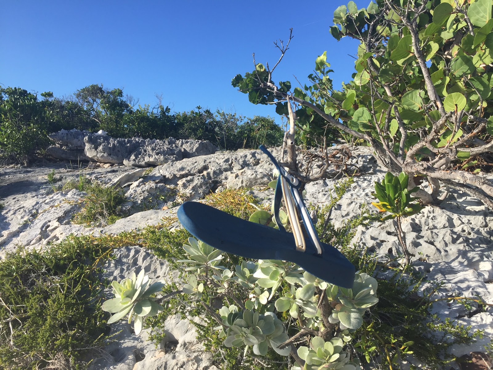
Trail marker
Off again on the
4th, a further 30 miles south to Buenavista Cay. Having
had the wind just too far aft the previous 2 passages, today it was
just too far forward. Most of the way we managed to sail close
hauled into an ESE F4-5 but we were threading out way between reefs
and had to motor sail for a couple of miles in the middle. Once
again, we arrived in time for lunch and a lazy afternoon. There is a
long double bay and 4 other yachts were anchored in the southern part
but, having had to share for the previous 3 weeks, we went our own
way and chose the smaller, northern one. Everyone else moved on the
following morning leaving us in splendid isolation with a couple of
miles of tropical white beach to ourselves. There had been one house
on the island built by a native Bahamian, who enjoyed interacting
with cruisers (and, allegedly, with other passing boats transiting
with high value cargo). Hurricane Irma, the previous September, had
wiped him out, leaving only foundations and a few chickens. That evening, watching the sun set below a perfectly clear horizon, we saw the 'green flash' for the first time since we were in trhe Aeolians 18 months earlier. Remarkably, the same happened the following evening. Either the atmosphere was particularly clear or I am making the 'sundowner' rum punches stronger than usual.

We had been planning
to spend 10 – 14 days exploring these islands but a check on the
weather that evening revealed that the strong Easterlies were
returning. With the exception of the coming Thursday, the wind would
be 20 – 25 knots as far as the eye could see. Not wishing to be
trapped, we determined that we only had 3 more days and to pick up
early the following morning and head down to Ragged Island at the
foot of the chain. We were delighted to be visited before leaving by
a local fisherman who swapped 4 lobster tails for the latest weather
forecast. The 25 mile sail down was a joy, with a F4-5 just ahead of
the beam almost all the way, giving us 8+ knots. Into South Side
anchorage, only to discover that, with a long fetch, the sea was too
rough to comfortably reach shore. We had been in 2 minds about doing
so anyway as the local town had been completely destroyed by Irma and
we didn’t want to gawk. Instead, we had a leisurely lunch and a
good catch-up on emails and other internetty stuff before picking up
and heading 15 miles back North to Racoon Cay. We averaged nearly
8.5 knots this time with the wind behind the beam and arrived with 5
minutes to spare before the beach gathering organised by the crew of
“Sam the Skull”, the brilliantly named Glasgow registered Cat.
Also present was “Desiderata”, who we keep bumping into and,
comparing notes, found that they had the same escape plan as us.
Another early start (though not as early as Desiderata) on Wednesday
and another brilliant 50 mile sail back to Water Cay.

Water Cay
Thursday was harder
work. We had about 6 miles of motor sailing, hard on the wind, 15
sailing on a close reach then 11 miles back through the Comer
Passage. This time we were near low water and had 2.0 – 2.2 metres
showing on the depth gauge. Desidera must have nerves of steel as
they draw a foot more than we do and kept pace with us. It was then
11 miles, directly into wind, back to Thompson bay. A couple of
year’s ago, we would have sailed this (or even a couple of weeks
earlier, when we were sailing deprived) but we just motored to ensure
we had plenty of time for a provisioning trip, as the wind was
forecast to get up again before morning. It did rise a little, but
not enough to keep us on board and we had a long walk (8 miles) round
the bay to Indian Hole point and back, pausing at Tiny’s for
Oh-So-Good conch fritters on the way back. The wind did get up that
evening and kept us confined for the next 4 days.


Post office at Thompson bay
Wednesday was a busy
day: early dinghy trip to the fuel station, to drop off our propane
tank (almost perfectly timed – it ran out just as I was finishing
cooking on Tuesday evening, so I had to connect up the old camping
gas for morning coffee); book swap and provisioning on the way back;
over to Tiny’s for laundry (miss-timing, so we were 3rd
in the queue) and a final trip back to collect the propane tank.
Thursday, it was time to move on and we had a nice downwind run,
first with just genoa and then with cruising chute, to Elizabeth
Island, entering via Middle Rocks passage. Wea found a pleasant
anchorage, on our own, which is remarkable for so close to
Georgetown. On Friday, we motored the couple of miles to anchor off
Regatta Point and make 4 trips ashore to top up with, free, R.O.
water. We also did a little shopping (finding mango juice –
hurray) and Elsie got her visitor’s visa extended.


Ruby on a pontoon.
On Saturday morning
I got an email reminding me that the subscription for our Navionics
chart-plotter charts was about to expire. The last couple of
occasions that I had tried to update them I had failed but decided to
have another go. Miracle! It worked and 2 hours later, I had an
up-to-date data card, which I put back in the chart-plotter and –
nothing. Was it the card? I tried 2 others and they also did not
work. We knew the data reader was poor and it looked as though it
had given up. Tried looking in the back and discovered that it was
hard wired in so, even if we could get a replacement, we would not be
able to fit it. I found a used display on ebay and made a quick
decision to buy it as I would be able to collect it next week. We
then wandered over to the other, more sheltered side of the bay. We
had discussed putting Ruby on a mooring while I was away and been
assured that there was no need to book. Now we discovered that they
were all taken. Tried to contact the owner, who is also the harbour
master, with no joy. Tried a couple of other providers but they had
no vacancy. On Sunday, I finally managed to contact the original man
and, after a lot of messing around found that we were out of luck so
it was the fall-back plan of travelling 12 miles downwind to Emerald
Bay Marina. This is attached to a Sandals resort and their premium
slips are way outside our price range but they do provide
non-serviced slips at $44 per night which, while it is $44 more than
we usually pay, is not bad for the area. Only problem is that they
do not answer the phone or emails and, with our poor radio
performance, we could not contact them until close, so it was a rush
to get there to ensure we had a berth, in case we had to return and
leave Ruby and Elsie swinging on the hook for 2 weeks. I say rush,
but it was a bit more measured as our chart-plotter now will display
no charts, just way points gleaned from other sources (and triple
checked) with 3 sources of charts on the iPhone to provide detail.
It all worked as well as could be hoped and, by 12:00, we were tied
up and secure for my trip back to the U.K.


I did leave Elsie with a beach to walk on.
Monthly distances
Logged 291
Over ground 269